

djm,
Find the steep section of road for which you want to calculate the gradient, it should be at least 100m long, but longer would be "better". Use the scale on the map to determine the length of the segment in meters. Try starting the measurement right on an elevation contour line and count the number of contour lines which cross the road to get to the end of the section; it may be best to pick the ending point right on a contour line.
If the road segment is 500m long, and 35 contours (at 5m elevation differences) cross the road by the end of the segment (the contour line at the beginning counts as zero, and the next one counts as one, and the last one right at the end of the segment counts), then enter the following in the google search box, and the answer displayed by google is the % grade of the road segment:
100*5*35/sqrt(500^2-25*(35)^2) . In this example, google provides the answer 37.3632358879, which is a little over 37%.
You only need to change the numbers in bold red, as follows: When you get the actual numbers from the map, put in the actual length of the segment in place of 500, and put in the number of contour lines crossed, in place of the 2 places in the formula in which 35 appears.
On the road today...
Moderators: robbosmans, Moderator Team
-
HammerTime2

- Posts: 5813
- Joined: Thu May 04, 2006 4:43 pm
- Location: Wherever there's a mountain beckoning to be climbed
-
stella-azzurra

- Posts: 5066
- Joined: Mon Jan 23, 2006 6:35 am
- Location: New York
I think Djm should ride it again  and get the run but it looks really short.
I never took drugs to improve my performance at any time. I will be willing to stick my finger into a polygraph test if anyone with big media pull wants to take issue. If you buy a signed poster now it will not be tarnished later. --Graeme Obree


Visit starbike.com Online Retailer for HighEnd cycling components
Great Prices ✓ Broad Selection ✓ Worldwide Delivery ✓
www.starbike.com


Love riding in France, great having parents who live here.
Much better weather than the UK, with better roads, less traffic, better cafe culture!
Todays ride was a very lumpy 90km, lots of climbing, great descents but a bloody headwind for the last 30km all the way home!
Made the "recovery drink" tast so much better!
-
CarpetFibre
- Posts: 556
- Joined: Thu Apr 01, 2010 10:24 am
Never bother trying to measure gradients with mapmyride, bikeroutetoaster or anything google maps based for short climbs. They terrain relief isn't high enough resolution. It works fine for much longer climbs like Mt Ventoux but I find it vastly underestimates the gradient of shorter climbs of <3km or so.
I wonder if it'd be possible (or if it already exists) to make an accurate gradient indicator on the bike by measuring the angle of the bike in the plane of travel? It'd be interesting for me as I always like to know gradients on hills I ride up, and measuring them on internet based maps doesn't give much quantitive indication at all as to how steep they are.
I wonder if it'd be possible (or if it already exists) to make an accurate gradient indicator on the bike by measuring the angle of the bike in the plane of travel? It'd be interesting for me as I always like to know gradients on hills I ride up, and measuring them on internet based maps doesn't give much quantitive indication at all as to how steep they are.
Last edited by CarpetFibre on Sun Sep 23, 2012 12:02 pm, edited 1 time in total.
-
stella-azzurra
- Posts: 5066
- Joined: Mon Jan 23, 2006 6:35 am
- Location: New York
I thought MapMyRide would average the gradient over longer distances.
Here you go:
iPhone apps Clinometer - level and slope finder
http://www.appleiphoneipad.net/iphone-a ... /4421.html
Here you go:
iPhone apps Clinometer - level and slope finder
http://www.appleiphoneipad.net/iphone-a ... /4421.html
I never took drugs to improve my performance at any time. I will be willing to stick my finger into a polygraph test if anyone with big media pull wants to take issue. If you buy a signed poster now it will not be tarnished later. --Graeme Obree


Just rode up the 4th cat climb near my parents house that the tour de France went over, they made it look easy I was doing 6mph by the top with an average heart rate of 178bpm, it was like riding up a bloody wall. The kom line was still painted at the top too.
-
stella-azzurra
- Posts: 5066
- Joined: Mon Jan 23, 2006 6:35 am
- Location: New York
<speaking as HammerTime2>
What is the gradient on that road? How long did it it take you to go the same distance as the TDF riders?
Did you go left or right at the blue arrow sign? Shouldn't the KOM line be at the very top of the hill?
<\speaking as HammerTime2>

What is the gradient on that road? How long did it it take you to go the same distance as the TDF riders?
Did you go left or right at the blue arrow sign? Shouldn't the KOM line be at the very top of the hill?
<\speaking as HammerTime2>
I never took drugs to improve my performance at any time. I will be willing to stick my finger into a polygraph test if anyone with big media pull wants to take issue. If you buy a signed poster now it will not be tarnished later. --Graeme Obree

<speaking as HammerTime2>
Is that tree on the left high enough to cover you from the sun?
Did you digest well your last meal before the ride?
How many hours do you work for each week?
<\speaking as HammerTime2>

Is that tree on the left high enough to cover you from the sun?
Did you digest well your last meal before the ride?
How many hours do you work for each week?
<\speaking as HammerTime2>
In no particular order:
90%
I was quicker
I went straight over the sign
KOM line has slipped down with natural erosion.
Tree wasnt high enough, so I employed a pit lane girl with an umbrella to run along side me in a bikini and heels
I had a steak dinner at the bottom of the hill as I needed the protein.
I work 0 hours per week, but do turn up at the office for about 40-45 hours each week and spend it surfing the net for bike porn.
JesseD wrote:Just rode up the 4th cat climb near my parents house that the tour de France went over, they made it look easy I was doing 6mph by the top with an average heart rate of 178bpm, it was like riding up a bloody wall. The kom line was still painted at the top too.
where are you riding in France?
My parents live in Moissac in the Midi-Pyrénées region, no big climbs but lots and lots of 1-2 mile climbs which can be brutal, great cycling country, very rolling and the roads are quiet. Love it!
They are now on about moving closer to the Alps, obviously I am all for it!!!
They are now on about moving closer to the Alps, obviously I am all for it!!!
some shots from yesterday's ride...miami southbound...
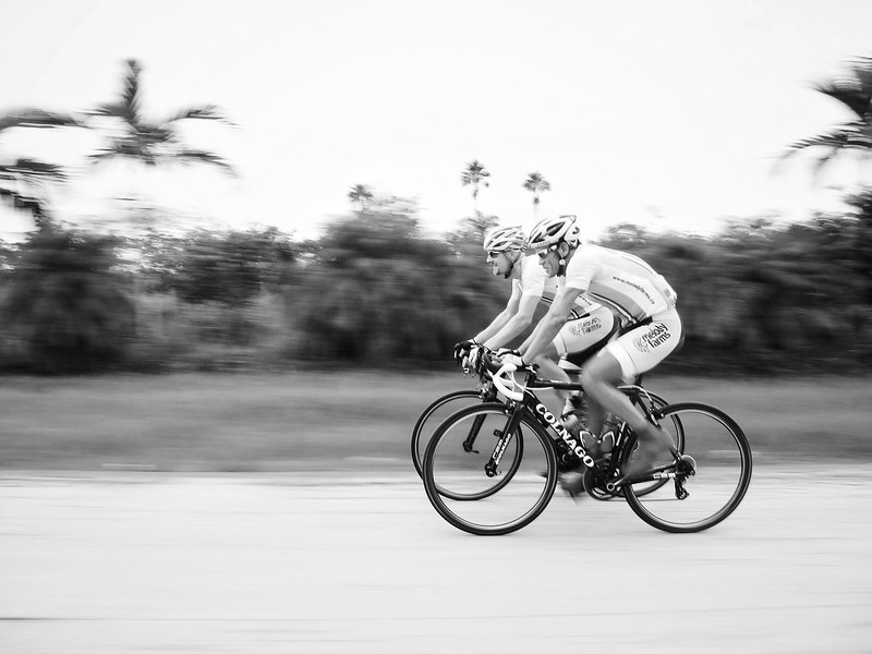
Camera Roll-905 by willy gil, on Flickr

Camera Roll-897 by willy gil, on Flickr
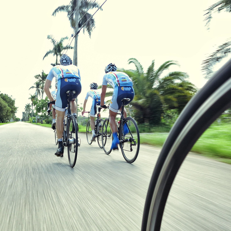
Camera Roll-903 by willy gil, on Flickr
Camera Roll-905 by willy gil, on Flickr
Camera Roll-897 by willy gil, on Flickr
Camera Roll-903 by willy gil, on Flickr
-
stella-azzurra
- Posts: 5066
- Joined: Mon Jan 23, 2006 6:35 am
- Location: New York
Wily you have taken up StephanR 's way of taking motion pics.
Nice.
Nice.
I never took drugs to improve my performance at any time. I will be willing to stick my finger into a polygraph test if anyone with big media pull wants to take issue. If you buy a signed poster now it will not be tarnished later. --Graeme Obree
Visit starbike.com Online Retailer for HighEnd cycling components
Great Prices ✓ Broad Selection ✓ Worldwide Delivery ✓
www.starbike.com


